Satellite Communication Tools
The GLG Toolkit (by Generic Logic) is a professional graphics framework used to build real-time, data-driven visual interfaces. It is widely used by aerospace and telecommunications agencies—such as NASA, FAA, and Collins Aerospace—to monitor telemetry, satellite tracking, and network operations.>Key features used in satellite and telecommunication systems include:Interactive HMI Editor: A point-and-click graphical builder that allows developers to design customizable diagrams, dashboards, and operator interfaces without writing manual code.Real-Time Data Visualization: Displays tens of thousands of data points to track satellite trajectories, signal latency, orbital dynamics, and telemetry data smoothly.GIS Mapping & Tracking: Features a built-in map server that displays global positions, satellite footprints, latitude/longitude, and tracking radar trajectories.Pre-built Widgets: Includes a massive library of avionics dials, meters, gauges, and network node icons used for satellite monitoring.Platform Support: Offers libraries for C/C++, Java, C#, and JavaScript/React/Angular for deployment across web, desktop, and mobile devices.For more details on integrating these capabilities into your projects, you can explore the official Generic Logic website.
The GLG Toolkit by Generic Logic is a powerful, cross-platform graphical development framework used extensively in satellite communications, aerospace, and defense industries. Major organizations like NASA and Collins Aerospace rely on it to build high-performance Human-Machine Interfaces (HMIs), telemetry dashboards, and real-time visualization systems.Rather than being a standalone satellite communications tool, it is an SDK/toolkit used to build the visual control rooms and tracking interfaces for space-based and satellite networks.Key Capabilities for Satellite & Space ApplicationsLow-Latency Telemetry Monitoring: The toolkit features high-performance engine architectures capable of handling tens of thousands of real-time data points simultaneously. This is critical for monitoring high-speed satellite downlinks, health stats, and payload performance.Integrated GIS Map Server: It includes a self-contained, offline GLG Map Server. It displays orbital projection paths, satellite footprints, and ground-station tracking directly over satellite imagery or vector maps without needing an active internet connection.Pre-Built Avionics & Instrumentation Palettes: The toolkit comes equipped with dedicated widget sets, including avionics gauges, 2D/3D plots, dials, and hardware meters to quickly assemble dashboards that mirror hardware control rooms.Radar & Simulation Integration: It is heavily utilized alongside defense simulation environments (like vsTASKER) and network-driven protocols to animate real-time trajectory tracking for radar systems and space-network coverage.
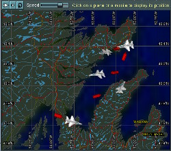
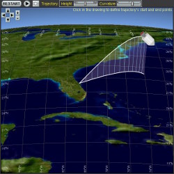
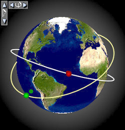
Reference image showing features of GLG Toolkit
Core Satellite Use CasesReal-Time Telemetry & Monitoring: Displays live network performance data—such as bandwidth, latency, and packet loss—using high-performance graphs and dynamic dashboards.Satellite Tracking & Trajectory: Integrates auxiliary orbital data (like TLEs) to plot and visualize the live positions of LEO (Low Earth Orbit), MEO (Medium Earth Orbit), and GEO (Geostationary) satellites.Ground Station Mapping: Utilizes embedded GIS mapping features to visually track satellite footprints, fields of view, and coverage zones over global or local terrain.Radar & Signal Analysis: Builds trajectory and radar simulators that visualize key parameters like azimuth, elevation, and range in networked test environments.Mission Control Displays: Creates customizable, mission-critical command centers to monitor uplink/downlink status and antenna pointing angles.
Downlaod - Satellite Communication Tools
Request for Trial licence
Download User Guide & reference manual
Key Features of the GLG ToolkitCross-Platform Compatibility: Provides libraries for C/C++, Java, C#/.NET, and Web/Mobile deployments (JavaScript, React, Angular, Next.js).Interactive HMI Editor: Allows engineers to design custom graphical panels and widgets without manual, line-by-line coding.Embedded GIS Object: Incorporates zoomable, pan-able maps directly into drawings without requiring an active internet connection.Dynamic Updates: Handles rapid changes in streaming data instantly, ensuring satellite tracking and telemetry screens do not lag.For further details on its use in monitoring systems, you can review the Generic Logic platform page. For hands-on testing, a free version is available on the GLG Toolkit Free Community Edition download page.